Monday, December 30, 2013

By Bill Bollman

Veteran no-tillers are increasingly interested in cover crops as a means to continue improving their soil’s health. The management mindset is no longer sustainability of what may well be a degraded resource, but one of improving and restoring that soil resource. The benefits to establishing a cover crop are many and include: erosion control, reduces nitrate and phosphorus losses, increases soil organic matter, increases biodiversity, weed suppression, soil moisture management, minimizes soil compaction and promotes biological nitrogen fixation.


 The economical and environmental benefits have farmers brainstorming on how to integrate cover crops into their production systems. The best method to accomplish cover crop seeding may vary between operations due to differences in geography and crop mixes involved, as well as differences in the labor and machinery available.

Here are some of the different methods utilized to establish cover crops:

Air Delivery Seeder behind Vertical Tillage Tool

Air Delivery Seeder mounted on Grain Header 
Rotary Harrow behind Broadcast Application

Seeding with No-Till Drill

Aerial Application into standing crop
For technical assistance in your area, please visit: http://www.in.gov/isda/2367.htm 

For more information on cover crops, please visit: http://ccsin.iaswcd.org/

Monday, December 23, 2013

Working to Protect our Resources

George Reger                     
Resource Specialist  - Team Leader
Job Duties: surveying, engineering, design and layout projects. I also work with the local districts with conservation projects.
Areas of Interest/Expertise: Working the public and delivering a conservation message to them.
Background:  I was raised on small farm in Boone Co. I was a 10 year member in 4-H, main projects were swine and beef.


On August 29, Jessica Norcross and I show the stream bank erosion table to the 4th graders from the Montgomery schools. The demonstration show the student that  without protecting our soils with cover crops and reduce tillage the damage can be costly. 


The Montgomery SWCD coordinate this field day and it was held the Cain’s farm.


Our goals at the end of a grass waterway that there will cleaner water. And looking upstream we can see the effect s of soil health taking place. At the end of day we should look back and be thankful for our resources. And hope tomorrow will be as colorful as rainbow.


Thursday, December 19, 2013

Funds Available for Livestock Promotion

ISDA – Office of Communications

Ben Kenney                                                 Abigail Maurer
Director of Communications                      Assistant Director of Communications
Tel.: 317-690-3303                                       Tel.: 317-605-6960
E-mail: bkenney@isda.in.gov                   E-mail: amaurer@isda.in.gov

Dec. 19, 2013
FOR IMMEDIATE RELEASE

Funds Available for Livestock Promotion

INDIANAPOLIS – Indiana State Department of Agriculture is offering three grants to champion Indiana’s livestock industry. The Indiana Livestock Promotion Grant, Indiana Livestock Market Development Grant, and the 4-H/ FFA Youth Livestock Grant. The deadline for all livestock grants is Feb. 1, 2014.

The 4-H/ FFA Youth Livestock Grant is an opportunity for 4-H or FFA chapters to “pay it forward.” Students can use the funds to help fellow students purchase breeding stock to start a livestock operation or to add animals to an existing operation.

The Indiana Livestock Promotion Grant is for qualifying organizations to submit project proposals designed to promote the livestock industry in Indiana through shows, sales, exhibitions, conventions, or similar events and programs.

The Indiana Livestock Marketing Development Grant is for qualifying organizations to submit project proposals for value added feasibility studies, research projects, market development, or other projects that encourage the development of business and industry related to livestock production, processing and distribution.


The deadline for grant applications is Feb. 1, 2014. For more information, please visit ISDA’s website.

Monday, December 9, 2013

Think Twice Before You Spray That Ditch


By Don Ryan, Resource Specialist
Don Ryan is a Resource Specialist with the ISDA Division of Soil Conservation in Southwest Indiana, stationed in Daviess County.  Don was raised on a small diverse livestock and crop farm.  He started his conservation career in Daviess County as a district technician and has been with the State for 26 years.


Several years ago, I was asked to look at a ditch with a producer.  This ditch was behind her house and just outside her horse pasture.  When I arrived, it was completely bare.  It had no vegetation, and the erosion was bad.    She had sprayed it earlier because she didn't like the tall grass and weeds growing out her back door.  She stated that it had really gotten out of hand, so she unknowingly traded in weeds and grass for a nasty looking brown and exposed soil ditch by eliminating the vegetation.  

Now, several years later, that ditch is mostly weeds and looks worse now than it did before it was sprayed.  Fortunately, some grass is coming back.

There is a time and a place for everything.  There are times when noxious weeds need to be removed and the most effective way to take care of them is spraying.  If broad leaf weeds are the major concern, maybe a chemical specifically for those weeds could be used.  Another option for weed control in ditches could be a systematic approach of spraying and reseeding, that might take a couple of years, so as to not have complete exposure at once.

An effective way to maintain a ditch is mowing and the good ol' weed eater on those steep banks.  This is not always the most fun way to take care of things, but it is very effective.  Just keep in mind that you don’t want to cut the grass too short.  The best way to protect that ditch from erosion is a good stand of grass with strong roots.

One last thing to keep in mind!  You are using a chemical in an open and flowing water course.  Please follow label directions for best results and safety.


Thursday, December 5, 2013

2013 Sullivan County Wabash River Raft Trip


October 1, 2013 marked the 13th Annual Wabash River Raft Trip organized by the Sullivan County Soil & Water Conservation District. Eighth grade student from around the area enjoy a day on the Wabash River learning about natural resources. 

Numerous volunteers are needed to assist with getting the students safely down the river in the rafts, making sure the lunch time break and learning stations flow smoothly. 

Students learn about river history, timber along the river, water quality, soils and how they all effect waters that are essential to life. DNR Officers are on hand to questions about fishing. There was a station about how to apply for a permit to do construction in a flood plain and students were urged to construct something to see how water flow would affect it.

 The eight mile trip had student looking for different resource along the way and using GPS to mark set points along the way. The last 4 miles of the 8 mile journey was a dash to the finish, all survived!

Wednesday, November 20, 2013

On Farm Network Part 2

By Jamen Frederick


This is Doug Hendrickson and his son Adam who farm in Warrick County.  They have taken advantage of the On Farm Network guided stalk sampling tests for their reclaimed mine land.  They feel that it is a great tool to assist them in checking their nitrate levels for corn fields. 


Don Ryan is demonstrating the sampling method for On Farm Network where stalk samples are taken from mature corn plants and analyzed for residual nitrate concentration in the stalks.  These samples along with aerial yield maps taken of the fields in summer help farmers assess their cultivation and fertilizer application practices.


 Some OFN sampling is being done strategically on adjacent field areas where cover crops have been planted next to areas where cover crops have not been used to assess differences in nitrate use in corn.


Monday, November 18, 2013

Indiana On-Farm Network

By Sarah Lake

Sarah Lake works for ISDA out of Kokomo and the surrounding four-county area, and is also a leader for the Conservation Reserve Enhancement Program administered by the state. She grew up in the Fort Wayne
area but an interest in environmental science took her to Purdue. After being graduated, she worked in county government before beginning at the ISDA Division of Soil Conservation.


Over 230 farmers across the state of Indiana are conducting nitrogen evaluations on their own farms through the Indiana On-Farm Network Program.  The goal of the evaluations is to collect data from right here in Indiana that will help producers maximize profit while reducing environmental impacts. 
There are 3 tools used to conduct the evaluations- Aerial Photography, Corn Stalk Nitrate Sampling and Replicated Strip Trials.

Aerial Photography is taken of the fields enrolled in the program while the crop is growing. This is done typically in August.  Many things can be seen from this photography including planter set-up issues, fertilizer application issues and drainage problems. 

Corn Stalk Nitrate Sampling is conducted in late September or early October after the corn plant stops taking up nitrogen.  4 sampling locations are chosen in each field, typically in different soil types.  10 corn stalks are collected at each sampling point.  The stalks are tested to see how much nitrogen remained in the stalk after the ear of corn stopped growing.  A high result indicates that more nitrogen was available in the soil than the plant could use in this particular growing season.  A low result indicates there was the potential the corn plant could need more nitrogen than was available that year.


Replicated Strip Trials are set up for producers who would like to see how their yield and efficiency is affected by using different rates of nitrogen, different forms of nitrogen, different nitrogen application timing or different placement of nitrogen.
Tipton County producers wanted to determine the amount of nitrogen remaining in the soil at the time of the Corn Stalk Nitrate Sampling this year.  Soil testing was incorporated into their On-Farm Network program. 


Producers will meet with other participants in their area this winter.  Producers benefit not only from their own data, but also by sharing information with each other.  There are currently 18 On Farm Networks in Indiana.  Over 600 fields are tested totaling over 40,000 acres.


On-Farm Network was developed in 2000 by the Iowa Soybean Association.  The Indiana State Department of Agriculture was awarded a grant in 2010 to develop the program in Indiana.  The Indiana Conservation Partnership along with the Corn Marketing Council and the Soybean Alliance continue to support and grow this program.
For more information regarding Indiana On-Farm Network go to: http://www.in.gov/isda/ofn/.


Monday, November 11, 2013

Working in Watersheds


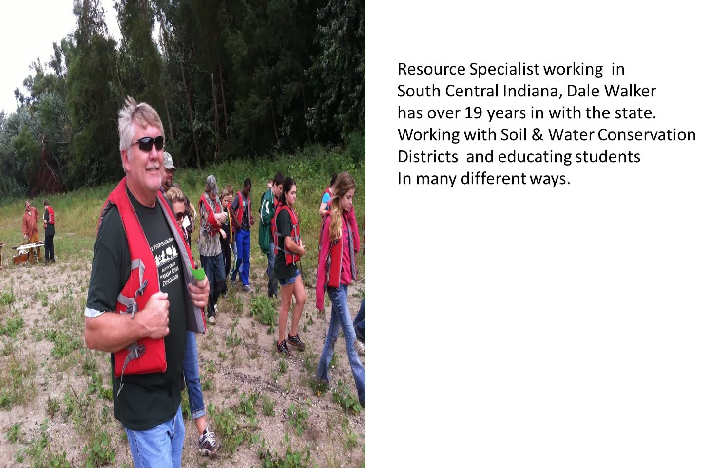
Hi I’m Sue a Resource Specialist with the Indiana State Department of Agriculture, Division of Soil Conservation. I have worked for the Division of Soil Conservation for 14 years serving the NW Central part of Indiana. I graduated from Purdue University with a Bachelor’s Degree in Natural Resources & Environmental Science, specializing in Aquatic Sciences.

With Soil & Water Conservation being the objective, my position is charged with providing technical and educational services to the local Soil & Water Conservation Districts, other units of government, and landusers.  One day I might find myself surveying for a best management practice on a farm and the next, teaching a group of students how to assess the health of their local waterbody. Conservation work all starts with knowing your watershed and the health of your local streams.
What is a watershed?


A watershed is the total area of land that drains into a particular waterbody (wetland, stream, river, lake, or sea).

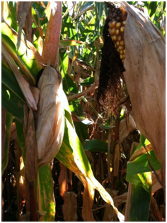
Land uses and runoff in a watershed determine the quality of surface water in smaller streams and waterways. They can then influence the water quality of larger streams. For example, point source discharges, urban runoff, runoff from landfills and runoff from agricultural areas may contain sediments, organic material, nutrients, toxic substances, bacteria or other contaminants. When these contaminants or pollutants are present in significant concentrations, they may interfere with some stream uses. So it’s important that watersheds be evaluated and assessed.

A tool used to evaluate watersheds:
ArcMap is the software I use to delineate or define watershed boundaries and evaluate other parameters for my projects.  This software allows multiple layers of information, such as, topographic data, soils types, landuse data, and hydrology data to be merged together so the watershed could be assessed.


This software also helps me to analyze various attributes of a watershed so that I can provide more specific recommendations 
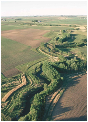
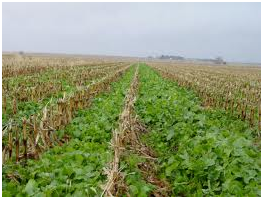
to my clients for implementation of various conservation practices. Practices such as conservation tillage, grassed waterways, rain gardens, rain barrels, 2-stage ditches, water & sediment control basins, vegetative filter strips all help to keep our waterbodies clean.


Biological assessment of your local waterbody or stream?
Simple observations of benthic macroinvertebrate presences can also be used to analyze the ecological health of bodies of water. Benthic macroinvertebrates are animals that are big enough (macro) to be seen with the naked eye. They lack backbones (invertebrate) and live at least part of their lives in or on the bottom (benthos) of a body of water.
Benthic macroinvertebrates include aquatic insects (such as mayflies, stoneflies, caddisflies, midges, beetles), snails, worms, freshwater clams, mussels, and crayfish. Some species are more tolerant of pollution, while others cannot live where there is pollution.
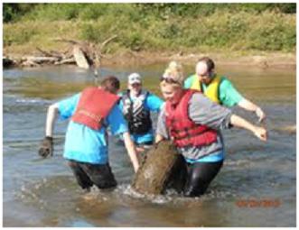
It is easy for citizens to become involved in ecological monitoring or participate in a stream clean-up of local water bodies.


If you’re interested in such activities contact your local Soil & Water Conservation District or Hoosier Riverwatch at http://www.in.gov/idem/riverwatch/2338.htm

Monday, November 4, 2013

Water History Lessons at the Pathway to Water Quality

Sarah Wolf is an ISDA Resource Specialist, serving Jasper, Benton, Newton, and Lake Counties.


The Pathway to Water Quality committee asked me to serve as a Live Interpreter, teaching water history and conservation, during the state fair to celebrate Pathway’s 20th anniversary.  Visitors enjoyed learning how to wash clothes the old fashioned way, and all the while I was teaching them how water was used 100 years ago.  

The point I wanted to get across to them was that water was often used for multiple tasks in the past, and we tend to waste a lot of water now because using water is convenient.  In the past, because water had to be carried in buckets from the well, water was conserved.  Pioneers would wash clothes with about five gallons, and then use that water to mop the floor or water their garden.  


Now we wash one load of clothes in the washing machine with about 60 gallons, and that water is not used for any other chore before sending it on to the sewage treatment plant or septic system.  The average household of three people uses an estimated 200 gallons of water every day!  

Visitors brainstormed ideas of how to use less water, and hopefully they will consider changing just one water practice in their everyday lives.  Water is a precious resource that needs to be conserved and protected, and together we can make a difference if we are mindful of how we use water!


Educators can find a water history lesson plan that I complied for 5th grade students (adaptable for younger students) at http://www.iaswcd.org/district_tools/pwq/pdfs/WHC.pdf.

Monday, October 28, 2013

The Four Cornerstones of Leadership: Leadership Institute

Geneva Rawlins is one of 5 District Support Specialists for the IN State Department of Agriculture- Division of Soil Conservation providing administrative support and leadership development opportunities for Indiana’s Soil and Water Conservation Districts. 


Ask anyone involved in any capacity within any community about the successes and struggles of their cause and most likely the common thread determining success or failure can be traced to leadership.  Any mission is dependent on leaders to envision, strategize and implement a plan for success, and preserving our natural resources for future generations is no different.  Our local Soil and Water Conservation Districts depend on the leadership of a Board of Supervisors to be at the forefront of the conservation movement in order to effectively serve our counties, and the Leadership Institute is one unique tool designed specifically to teach and challenge our local natural resource leaders and Soil and Water Conservation Districts. 


A series of four workshops build on each other, starting with defining what leadership is and how our personalities and perspectives affect how we serve within leadership positions.  Following workshops examine how we may better communicate with and listen to those we serve, and how Board dynamics effect the effectiveness and success of a Soil and Water Conservation District.  Finally, the Leadership Institute wraps up the series by discussing how we may further impact our communities through strategic planning and implementation. 


Because each workshop is hosted in a different location, an evening of networking is usually planned which also gives participants an opportunity to experience a unique aspect of the local community.  The  most recent Leadership Institute workshop was hosted in Lafayette, IN and Supervisors and Staff from Soil and Water Conservation Districts across the state participated in a Howl Night at the local Wolf Park, where they were given limited interaction with the wolves through howling & communicating with the wolves. 


The next Leadership Institute workshop will focus on communicating and building relationship in your community and with partnering agencies and other organizations.  This workshop will take place Dec 6-7 in Madison, IN, with a Christmas home tour to follow the evening of the 6th.   Please contact your local Soil and Water Conservation District for more information!

Thursday, October 17, 2013

Indiana vs. Alaska


By David Lefforge
David was raised on a farm, and has worked in soil conservation for the 36 years.  His job descriptions have changed from Soil Scientist, to Urban Conservation Specialist, to Resource Specialist as the agency has evolved from the State Soil and Water Conservation Committee, IDNR, to the Division of Soil Conservation, ISDA.  David lives in Bluffton with his wife, Julie.  He has 2 grown children and 2 grandchildren.


My wife and I recently took a trip to Alaska and thoroughly enjoyed that great state.  We visited the coastal rain forests and southeastern Alaska, including Denali.  
Denali in the distance

There was so much to learn about the geology, history, plant communities and wildlife, across a variety of environments:  Pacific coastal waters, fresh inland bodies of water, mountains, and glaciers.
Ice Disintegrating near the bottom of a glacier where melt has exceeded snow accumulation

Stream braided with outwash sediments from glacial meltwater.

Soil and Rock contrast to the snow and blue glacial ice.

Sediment- Down to the Sea in Ice

  
Aerial View of Lateral and Medial Moraines decorating a Valley Train Glacier


There are vast areas that are undeveloped and beautiful.  The Fall color change, especially in Denali National Park, was a highlight of our trip. 
Foraging moose standing in the colors of Fall

Unfortunately that beauty is based on thin soil, steep land, and a cold climate.  Consequently, there was little evidence of agriculture in Alaska.  The economy of Southeast Alaska is limited to tourism, fishing hunting, and forestry.
Bear foraging on blueberries(red leaves)among the willows


Evidence of current and past glaciers were everywhere in AlaskaAlaska is a theater for viewing glaciers; seeing glacial moraines, braided streams, and ice disintegration features in their infancy.   
Blue Glacial Ice calved from a glacier into a mountain lake impounded by a recessional moraine

These are the same features we see evidenced in the glaciated soils of Indiana where glaciers were last seen 10-15,000 years ago.
As pretty as it was, Alaska made me appreciate the natural resources we have in Indiana.  
Coastal Rain Forest-Trees growing from decaying tree, essentially no soil

Pasture Stocking Rates for Dall Sheep are quite low (See white specks?)

We have Prime Farmland and a climate well suited for agriculture.  We have woodlands and wildlife… but we also grow row crops and raise livestock. Agriculture is a valuable part of the Indiana Economy.

Alaska is a nice place to visit, but I choose to live in Indiana.